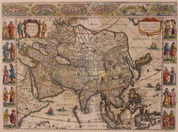
Asia 1638 - 1642
Jodocus Hondius
PapierDruck
45 ⨯ 56 cm
€ 3.450
Inter-Antiquariaat Mefferdt & De Jonge
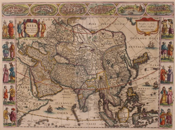
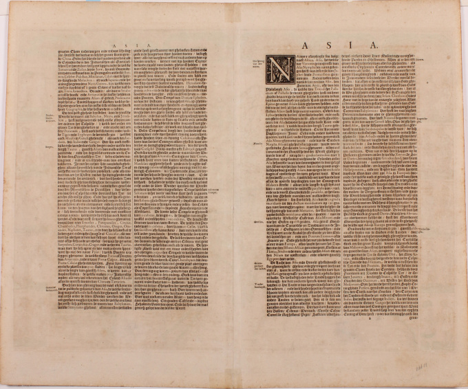
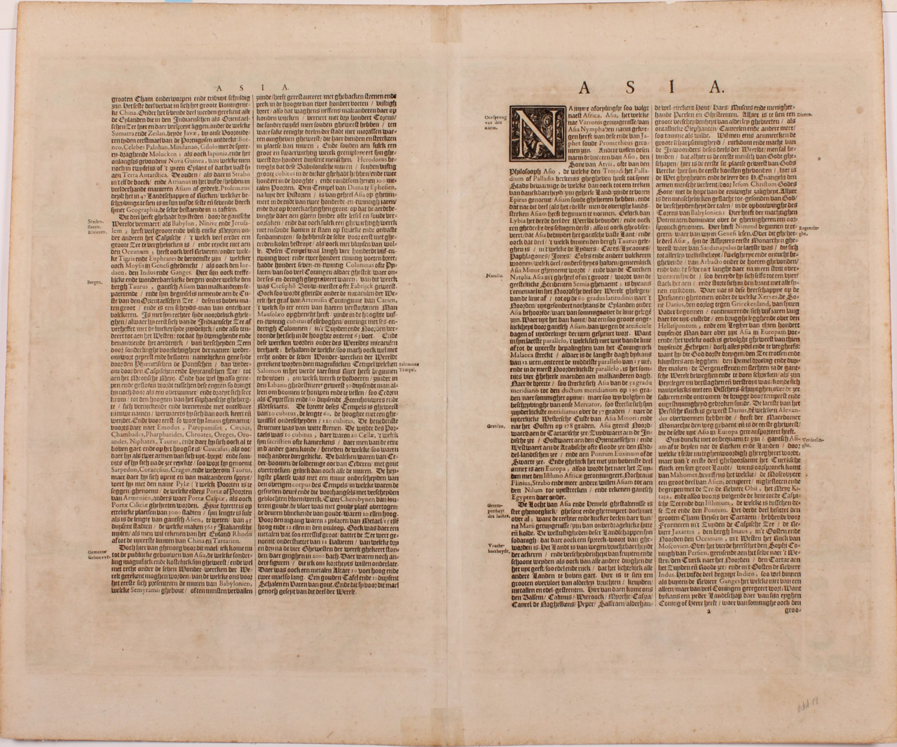
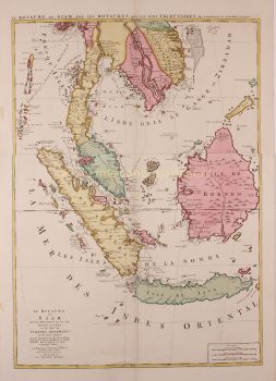
- Über KunstwerkFINE RARE CARTE À FIGURES MAP OF ASIA "Asia recens summa cura delineata Auct. Iud: Hondio". Copper engraving by Jodocus Hondius, published in Amsterdam between 1638-1642 (4th state) by Jan Jansson. With original hand colouring. Verso: German text. Size: 45,5 x 56,5 cm. This highly attractive map embraces all of Asia. The Middle East is very well formed, although the Caspian Sea has the egg-like form it maintained on maps until the 1730s. The Arabian Peninsula is well defined, based on Portuguese sources, and India takes its form after the maps of the Dutch adventurer, Jan Huygen van Linschoten (1596), which, in turn, borrowed from Portuguese sources. Southeast Asia and the Indonesian Archipelago are derived from charts made for the Dutch East India Company (VOC), while China is derived from Jesuit sources, although Korea is an oddly elongated peninsula. The geography of the region would remain an enigma to Europeans until the early 18th Century. Japan's Honshu and Kyushu are recognizable, although the area further to the northeast remains a vast mystery. True to the carte à figures' style, which was the hallmark of the great contemporary period of Dutch Baroque cartography, the map is surrounded on four sides by registers of fine vignettes. Along the top of the map are views of Famagusta (Cyprus), Rhodes (Greece), Damascus, Jerusalem, Aden and Hormuz (Persia). Along the left side of the map are depictions of people in local costume including Syrians, Arabs, Armenians & Persians, Indians, and Sumatrans. On the right side are depictions that include Javanese, Moluccans & Bandans, Chinese, Russians and Tartars. Along the bottom of the map there are further town views of Dutch trading posts Goa (India), Calcutta (Bengal/India), Kandy (Ceylon), Bantam, Gammalamme (Moluccas) and Macao. In addition the map is embellished by a fine title cartouche and ships and sea monsters in the seas. The map was originally conceived by Jodocus Hondius the Younger (1594-1629), whose eponymous father played a large part in the rise of Amsterdam as the dominant cartographic production centre in the 17th Century. The present edition of the map is by Jan Jansson (1588-1664), who married Jodocus the Younger's sister Elizabeth. He transformed the Hondius firm into a powerhouse of geographical publications. Jansson most notably published the Atlas Novus (1638), and the Atlas Major (1660), the 11 volumes of which included a town atlas, a hydrographic atlas, an atlas of the ancient world, and Andreas Cellarius' incomparable celestial atlas. Jansson's works were rivalled only by those of his arch-nemesis Joan Blaeu. The present map is one of the finest depictions of Asia from the apogee of Dutch cartography. Price: Euro 3.450,-

- Über Künstler
Jodocus Hondius (17. Oktober 1563 – 12. Februar 1612), auch bekannt unter der latinisierten Form seines niederländischen Namens Joost de Hondt, war ein flämischer Kupferstecher und Kartograf und eine der prägenden Figuren des Goldenen Zeitalters der niederländischen Kartografie. Um ihn von seinem Sohn zu unterscheiden, wird er oft als Jodocus Hondius der Ältere bezeichnet.
Hondius erlangte Berühmtheit durch seine außergewöhnliche Fähigkeit, technisches Können im Kupferstich mit geografischer Gelehrsamkeit zu verbinden. Er ist vor allem für seine frühen und einflussreichen Karten von Europa und der Neuen Welt bekannt, die das visuelle Verständnis der neu entdeckten Gebiete in Europa um die Wende zum 17. Jahrhundert maßgeblich prägten. Seine Karten zeichnen sich durch Klarheit, Präzision und detailreiche Dekoration aus – Eigenschaften, die sie sowohl zu maßgeblichen wissenschaftlichen Dokumenten als auch zu begehrten Kunstwerken machten.
Ein Wendepunkt in Hondius’ Karriere war der Erwerb der Originaldruckplatten von Gerardus Mercator. Zu einer Zeit, als Mercators Ruhm zu schwinden begann, veröffentlichte Hondius diese Tafeln neu und erweiterte sie, indem er seine eigenen Überarbeitungen und neu gewonnene geografische Erkenntnisse einfließen ließ. Dies belebte nicht nur Mercators Erbe wieder, sondern sicherte auch seinen nachhaltigen Einfluss und führte zu den berühmten Mercator-Hondius-Atlanten, die die europäische Kartografie über Jahrzehnte prägen sollten.
Neben der Kartografie war Hondius auch ein begabter Porträtstecher. Seine Porträts von Francis Drake zählen zu den bekanntesten Darstellungen des berühmten englischen Seefahrers und belegen Hondius’ Vielseitigkeit und seinen kulturellen Horizont.
Als eine der zentralen Figuren des Goldenen Zeitalters der niederländischen Kartografie (ca. 1570–1670) trug Hondius maßgeblich dazu bei, Amsterdam als führendes Zentrum der Kartografie im Europa des 17. Jahrhunderts zu etablieren. Sein Werk verband Kunst, Wissenschaft und Handel und prägte die Art und Weise, wie die Welt kartiert, verstanden und imaginiert wurde. Heute wird Jodocus Hondius der Ältere als Meisterstecher, innovativer Verleger und einer der wichtigsten Wegbereiter der modernen Kartographiegeschichte in Erinnerung behalten.
Sind Sie daran interessiert, dieses Kunstwerk zu kaufen?
Artwork details
Related artworks
- 1 - 4 / 6
- 1 - 4 / 24
Jean-François Rauzier
Oasis Hotel - Limited edition of 8 2017
Preis auf AnfrageVilla del Arte Galleries
Cornelis Anthonisz Theunissen
SEHR SELTENE ERSTE GEDRUCKTE KARTE VON AMSTERDAM, EINER STADT AUF DEM AUFSTIEG1544
€ 125.000Inter-Antiquariaat Mefferdt & De Jonge
Kuratiert vonDanny Bree
1 - 4 / 24- 1 - 4 / 24
- 1 - 4 / 12